In the Chilean Lake District, right opposite the Osorno Volcano, Llanquihue rests on the southwestern margin of the lake bearing the same name, between the Cities of Puerto Varas and Frutillar. It is accessed through the Chilean Panamerican Road, also known as Route 5 South or The Lakes Motorway.
The original name of the lake was “Drain”, as the Maullín River empties its waters in it. However, the name was changed to Llanquihue in 1897, which in the Mapuche tongue means “sunken site”.
Peace rules over the city. The lake, the volcanoes and the soft meadow create precious postcards for visitors to behold. The main activities in the area are tourism, agriculture, cattle raising and agricultural industry.
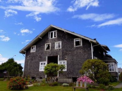
The first German immigrants settled down on the lake shores bringing along their customs, their architecture and traditions, which today are part of the local tourist attraction. Some examples are the Beer Festival and the cured meat industry.
The “ride around Lake Llanquihue”, a traditional circuit accessed through any of the cities lying on the shore, may of course start at Llanquihue. Its length is 186 kilometers and the picturesque Cities of Frutillar, Puerto Varas and Puerto Octay are located on this road.
Vicente Pérez Rosales National Park, surrounded by the Osorno, Puntiagudo and Tronador Volcanoes, lies 60 kilometers away from the district. This is the oldest park in the country, which boasts large extensions of native forest, cascades and a rich diversity of wildlife. Various activities such as fishing, hiking and wildlife mapping may be enjoyed in this area.