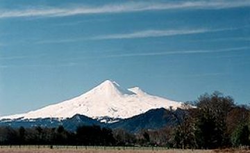
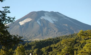
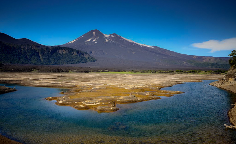
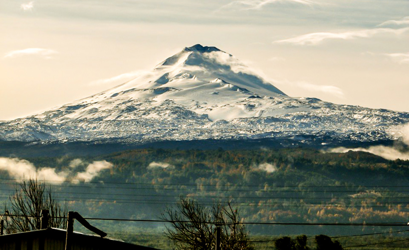
Large and generous, Conguillio National Park welcomes different kinds of tourists. There are those who come just to stay closer to nature and keep every sunrise and sunset as a valuable treasure, without making great efforts. Whereas, others come to enjoy walking on attractive trails and take advantage of their free time to put on their backpacks and their best mountain trainers and go hiking. They let their own inner GPS flow to add up kilometers and spend the night in sleeping bags inside a tent. We drove along the route between Temuco and Paso de Icalma. Firstly, we saw the Llaima Volcano and, afterwards, the national park. We became aware that both places were connected and their natural beauties intermingled with each other. We got inside the park from Curacautin town and took a road within the park that led us to Captren Pond. It is a small area which includes a campsite and a trail from where visitors can have a closer view of the pond and even fish from the shore. This vantage point allowed us to see the Llaima Volcano. We took our first photos, since we could not help watching such a scene.
Conguillio, a Volcano-encircled National Park
-
Large and generous
-
This model Chilean park
-
Llaima Volcano
-
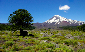
The thick forests of monkey puzzle trees
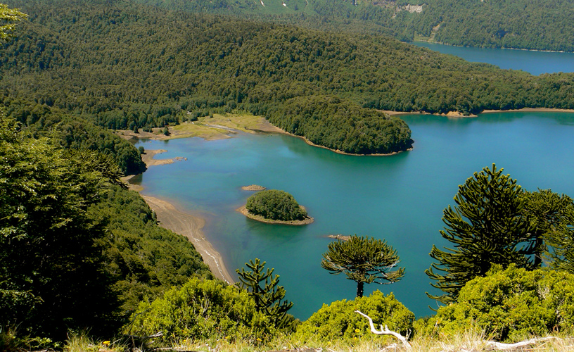
This trail led us, a few kilometers ahead, to Lake Conguillio, the largest in the park. The office of the Chilean National Parks and Wildlife Service (CONAF - Confederación Nacional Forestal de Chile), the Environmental Information Center and a services area rest on its shores. The great number of visitors attracted by this location added some color and active life to the cabins and the campsite. As we visited this place in summer, park rangers were rather busy. When we had the chance to talk with one of them, we were given some brochures for the interpretation of trails, their lengths, skill levels and walking time. This was useful information for a better orientation inside the park and to enjoy an excellent stay. Several young people with their backpacks on and ready to start walking told us: “We haven’t seen everything yet, but this park has an incredible variety of ecosystems and every corner is unique. Now, we will take a trail in search of the “Mother Monkey Puzzle Tree” with a 2-meter trunk diameter”. We wondered: if a monkey puzzle tree needs 200 years to reach maturity and 500 years for its umbrella-like branches to grow, then, how old was this old female tree? We saved this question for our next meeting with a park ranger. The presence of park rangers all around the area is necessary to have permanent control and provide information services. There are signposts, well marked trails and sections where fishing is allowed. However, visitors can enjoy this place provided that they take care of these valuable natural beauties. Following the trail, we found a nice spot on the lake shore to have our afternoon snack. Lying on our backs on the soil, we stared at the astonishing number of monkey puzzle trees at our sight above us. In the middle of dense vegetation, we could find volcanic ashes and isolated sections hard to describe. We should trace back to thousands and thousands years ago and know the evolution of volcanic activity evidenced in the terrain. The dynamic “Las Araucarias Ski Resort” on the western hill of this park with great quality of snow in the winter season is another wonderful spot that deserves to be mentioned (linkear a “Skiing through Monkey Puzzle Trees and Fumaroles). Our tour through Conguillio National Park was short but intense. We were thinking about the idea of planning another visit in the future, during which we could stay overnight and taste every natural beauty this model Chilean park has to offer.
![]() Mónica Pons
Mónica Pons ![]() Gentileza CONAF
Gentileza CONAF
Araucanía Region – Chile
Distance from Temuco through Curacautin: 122 kilometers
Distance from Temuco through Melipeuco: 135 kilometers
Accessible from November to April (In winter snow accumulation may occur)
CONAF is the administration’s office. An entrance ticket is required.