No sooner had the brochure reached our hands than the description of the excursion, more than promising, quickly turned into an obsession: “Our flight explores the landscapes of the southern gateway to Chile, with Puerto Montt as its starting point, a region covered in forests, volcanoes, lakes, estuaries, and islands. The route reveals how this part of the Los Lagos Region was shaped, with a geography defined by glacial movements, volcanic activity, the erosive force of water and wind, and the enduring green mantle of ancient forests that remain…”
Flying among Volcanoes
The geography of Chile’s X Region offers a privileged setting for flight, where forests, lakes, estuaries, islands, and volcanoes come together to create an unforgettable landscape.
-
Cloudless days
-
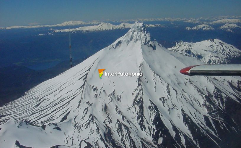
The Osorno
-
Osorno, touch the summit with our own hands
-
Puntiagudo Volcano
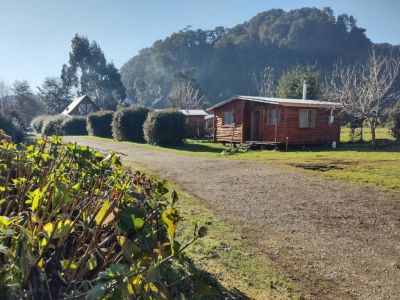
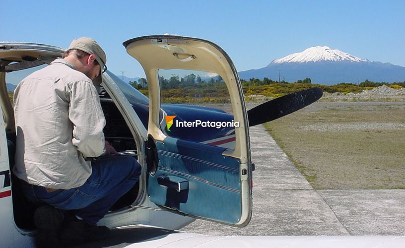
Take - off in Puerto Montt
We took off from the aerodrome of the city of Puerto Montt, although the tour can also begin in the nearby town of Puerto Varas. At both flying clubs, twin-engine aircraft with seating for five to seven passengers await visitors, ready to demonstrate how the landscape becomes truly majestic when seen from the air.
Even the control tower itself is worthy of a photograph. Its façade is clad in larch shingles, reminiscent of the traditional houses of southern Chile. As soon as the small plane lifted its nose, cultivated fields, the vast expanse of Lake Llanquihue, and the deep blue waters of the Reloncaví Sound began to take center stage before our eyes.
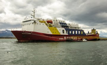
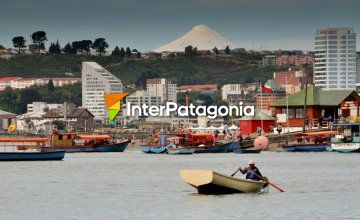
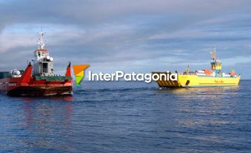
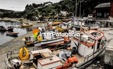
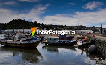
From above, the small towns of Puerto Varas, Frutillar, and Ensenada lay beneath us, along with the port city of Puerto Montt, with its boats, shipyards, and fishermen. The harbor of Angelmó and, in the distance, the silhouette of Chiloé Island gradually faded behind us as we crossed the dense green canopy of the ancient Alerce Andino National Park, the salmon farms visible in the Reloncaví Estuary, and the river mouths that flow into it.
While our questions could not keep pace with everything our eyes were taking in, Santiago Vidal, the pilot of the aircraft, described each of the landmarks that stood out from the air. The Calbuco and Yate volcanoes—so closely tied to the landscape of Puerto Montt—the Tronador and Puntiagudo peaks, Lakes Chapo, Todos los Santos, Rupanco, and Llanquihue, as well as Alerce Andino and Vicente Pérez Rosales National Parks, were all pointed out with the confident gesture of someone who has flown this region for years.
Osorno, the Landscape’s Protagonist
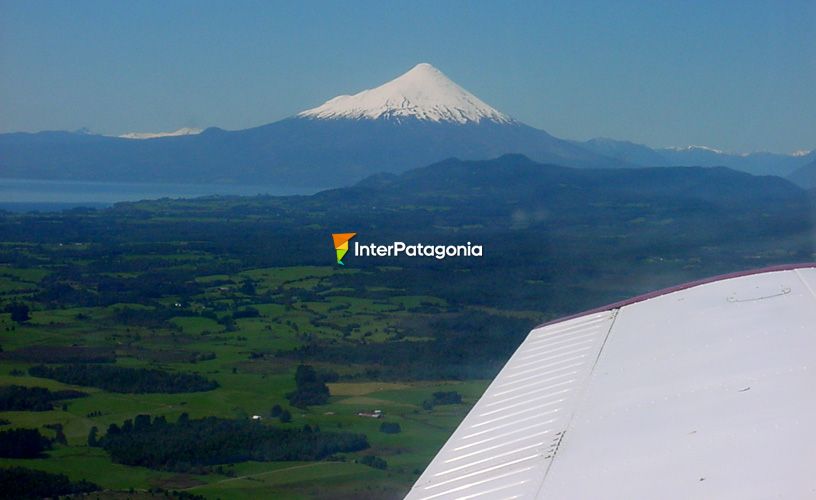
The first volcanoes to come into view are Yate and Calbuco. Yet the one that truly captures attention is dark green and black, with a fully snow-covered summit and snowy arms stretching nearly to its base. From the aircraft, its presence is impossible to ignore.
Still, Santiago had promised that highlight for the end of the journey, so we soon headed toward the Andes Mountains. Flying over the immense Lake Todos los Santos, with its intense turquoise hue, we spotted the source of the Petrohué River and its famous waterfalls, the Casa Blanca and Puyehue volcanoes, and the national park that bears the same name.
On the other side of the Andes, at more than 3,000 meters above sea level, we were left in awe by Lake Nahuel Huapi, Mount Tronador with its black glaciers, and Cerro Catedral, distinctive for the jagged peaks of its summit. Far off in the distance, standing alone, the massive white presence of Lanín Volcano seemed to watch our flight in silence.
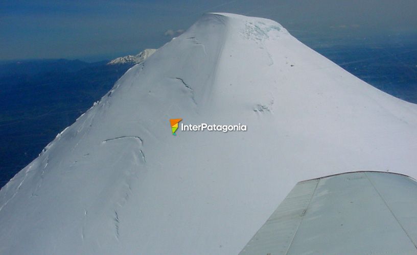
Photos here, photos there. The plane began to turn slowly, and Santiago, looking us in the eye, simply said, “Now is the moment… Osorno.” Our hearts could hardly believe where we were—or that, after so many breathtaking views, there could still be one that made all the others seem small.
Lake Puyehue and Lake Rupanco slipped behind us, as did the elegant Puntiagudo Volcano. And there it was: Osorno. Just as it appears in school textbooks and geography maps, with its classic dark green and black slopes adorned with arms of eternal snow. Its presence drew us in. The small plane—now truly small—approached the white wall as if the mountain itself were a magnet.
The summit hypnotized us, and toward it we flew. Santiago, proud of his volcano any Chilean, approached cautiously as we circled and photographed it, until we were so close it felt as though we could almost touch the summit with our own hands—or at least, that was what we wished.
Putting into words the feeling of this final encounter is no easy task. As the aircraft begins its return and slowly descends toward Puerto Montt, one thing becomes clear: we have experienced something truly unique. From the air, Osorno Volcano reveals its perfect silhouette in all its grandeur, confirming why it is one of the great natural icons of southern Chile—and the ideal finale to this aerial journey.
![]() Pablo Etchevers
Pablo Etchevers ![]() Pablo Etchevers
Pablo Etchevers
Flights depart from the aerodromes of Puerto Montt and Puerto Varas.