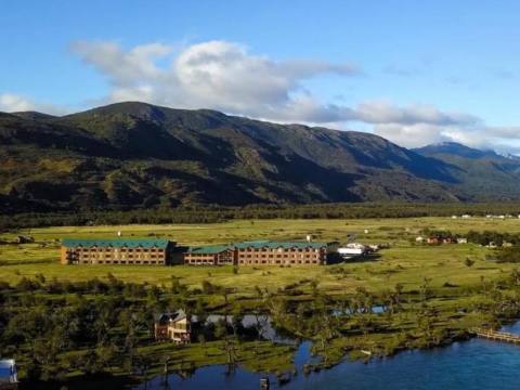
At the southern tip of the continent, Southern Patagonia brings together some of the world’s most famous landscapes: the Perito Moreno Glacier, Fitz Roy, the towers of Paine, the Strait of Magellan and the Beagle Channel. The border between Argentina and Chile is crossed several times, so it is best planned as a single trip.
The route
One way to plan it is as a loop: Río Gallegos → El Calafate and El Chaltén → Puerto Natales and Torres del Paine → Punta Arenas → Strait of Magellan → Tierra del Fuego to Ushuaia. You can start at any point.
Stops
Río Gallegos
The capital of Santa Cruz is Argentina’s southernmost mainland city and a good starting point. It has museums and an estuary with thousands of birds. From here you can visit the Cabo Vírgenes Reserve, one of South America’s largest penguin colonies, with over 150,000 Magellanic penguins from October to April, and Laguna Azul, in a volcanic landscape.

Magellanic penguins at Cabo Vírgenes. Foto: CamiPetenatti · CC BY-SA 4.0 · Wikimedia Commons
El Calafate and the Perito Moreno Glacier
On the shore of Lago Argentino, El Calafate is the gateway to Los Glaciares National Park. The Perito Moreno Glacier, some 80 km away, has a 5 km front rising about 60 m above the water; you view it from walkways, sail in front of it and can walk on the ice with guides and crampons. Boat trips leave from the lake to the Upsala and Spegazzini glaciers.
El Chaltén and Fitz Roy
In the northern part of the park, at the foot of Mount Fitz Roy (3,405 m), El Chaltén is a mountain and hiking village. The best-known trail leads to Laguna de los Tres, at the foot of Fitz Roy, through lenga forest and past streams.

Fitz Roy and Cerro Torre at sunrise, from El Chaltén. Foto: Almonroth · CC BY-SA 3.0 · Wikimedia Commons
Puerto Natales and Torres del Paine (Chile)
Puerto Natales, on the Última Esperanza Sound, is the gateway to Torres del Paine National Park, about 60 km away, with the Paine massif, lakes Grey and Pehoé and the Grey Glacier. On the way is the Milodón Cave, where remains of this extinct animal were found. From El Calafate you cross at Cancha Carrera or Mina Uno–Dorotea.

The Cuernos del Paine from Lake Pehoé. Foto: Pedro Szekely from Los Angeles, USA · CC BY-SA 2.0 · Wikimedia Commons
Punta Arenas and the Strait of Magellan
Punta Arenas, founded in 1848 on the strait, is the capital of the Magallanes region. From Cerro de la Cruz you can see the city and the strait. To the south, a coastal road leads to Fuerte Bulnes and Puerto del Hambre, the first settlements on the strait.

The Strait of Magellan from Punta Arenas. Foto: Cuidro · CC BY-SA 4.0 · Wikimedia Commons
Tierra del Fuego: Porvenir, Río Grande and Tolhuin
To reach the Isla Grande de Tierra del Fuego you cross the strait by ferry: at the Primera Angostura narrows or from Punta Arenas to Porvenir. On the Argentine side, Río Grande is the island’s largest city, and Tolhuin, the only town between Río Grande and Ushuaia, sits at the head of Lake Fagnano.
Ushuaia and Tierra del Fuego National Park
Ushuaia, on the Beagle Channel, is the departure point for trips to Antarctica. The old prison is now the Maritime and Prison Museum. 12 km away, Tierra del Fuego National Park is one of the few Argentine parks with a sea coast; you get there on Route 3, which ends at Lapataia Bay, on the End of the World Train or by catamaran along the channel.

The End of the World Train, in Ushuaia. Foto: Mark Fischer · CC BY-SA 4.0 · Wikimedia Commons
When to go
The busiest season runs from spring to autumn. From November to March, the Integración Austral crossing (Río Gallegos–Punta Arenas) is open 24 hours; from April to October, 8 am to 10 pm. The Cabo Vírgenes penguins are there from October to April. In winter, chains are recommended for the road to Torres del Paine.
Getting there
There are flights to El Calafate (about three hours from Buenos Aires), Río Gallegos, Punta Arenas and Ushuaia. By road, National Route 3 follows the coast to Ushuaia and Route 40 runs along the Andes. Between Río Gallegos and Punta Arenas you cross at the Integración Austral pass; to Tierra del Fuego, by ferry across the Strait of Magellan.